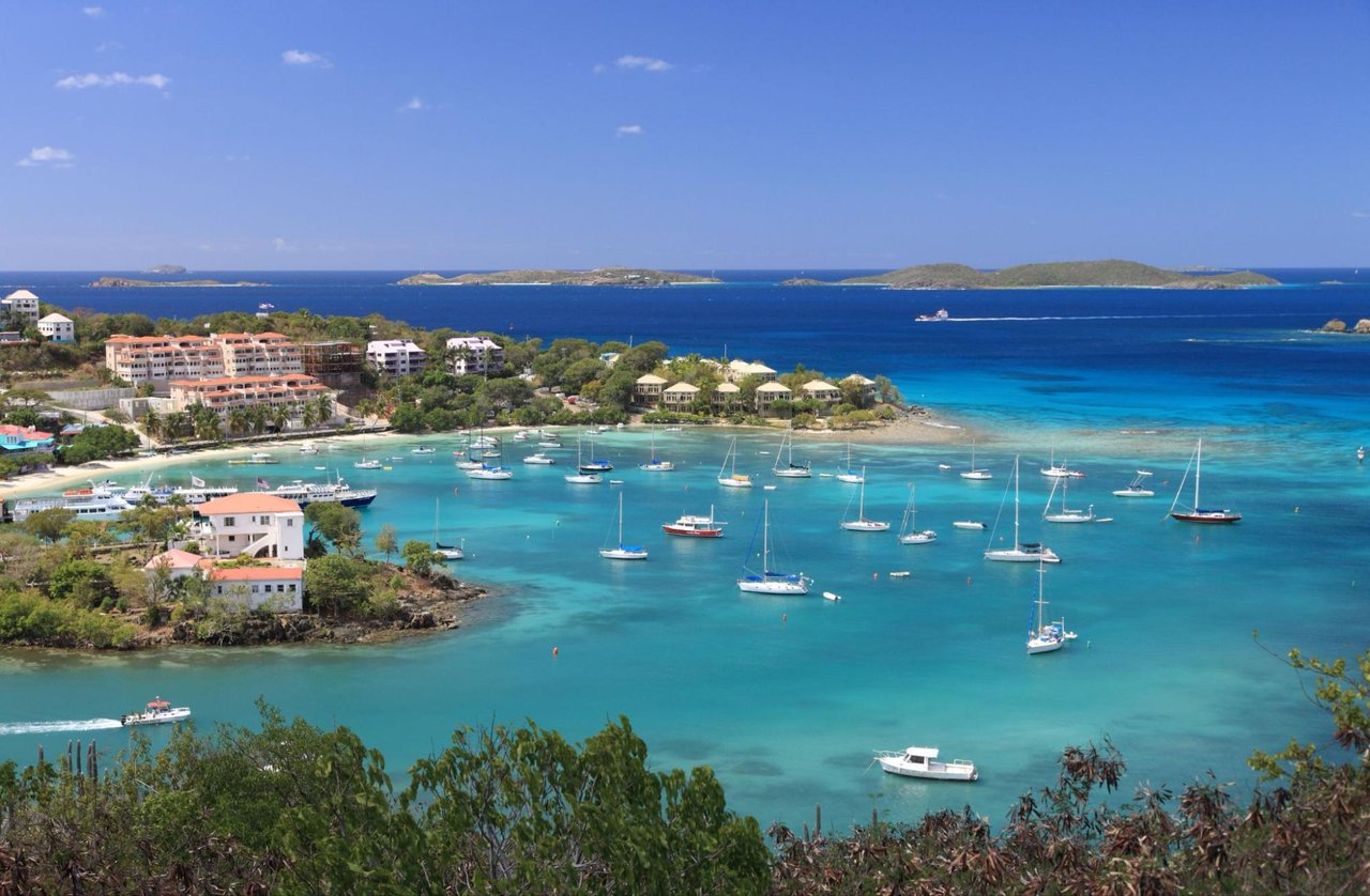
The Nancy Woodson Spire Nature Preserve is hard to see from Marina Drive. It isn't one park with a single trailhead. It's a set of parcels left untouched among the homes of Fish Bay, at the base of the hillside, and together they cover nearly 50 acres of guts, salt pond, mangroves and several kinds of forest. The land was drawn to follow the water, and right now there is water to follow. The territory gets its heaviest rain from August through December. October is when the preserve works the way it was meant to.
For anyone on the south shore near Rendezvous, this is the most interesting new walk close to home this fall. You can do it in one morning. It runs from a signed garden of native trees, up a rocky gut, and down to a salt pond full of birds.
The Preserve Changes With the Rain
Most of the guts in the Virgin Islands don't flow all year. In the dry months, usually December through April, the only freshwater left in them sits in shallow pools that aren't connected to each other. Anything living in a pool has to survive there for months. Once the rains come, the pools link up again and the animals can move between them. DPNR's feature on the preserve names two of the residents: nerite snails grazing algae off the rocks, and the carrot-nose shrimp, Xiphocaris elongata.
In heavy rain these guts can run several feet deep and fast, and they carry everything in them downhill. That's why the preserve is shaped the way it is. The St. John Source described it as spanning two guts that each run from shore to ridge. The land protects the path water takes, not one particular view.
Whether the gut is running when you go depends on the past few days of weather. A walk in March and a walk in October can look like two different places.
Stop One: The Garden on Marina Drive
DPNR suggests starting at the St. John Native Plant Garden, on Marina Drive as you head into Fish Bay, where there's roadside parking. The garden opened in 2010 through the Island Resource Foundation, with help from an Urban and Community Forestry grant. Volunteers from the Estate Fish Bay Owners' Association, guided by St. John horticulturalist Eleanor Gibney, pulled out invasive plants and built trails with signs naming the native trees. The goal was practical. The garden was meant as a living guide to the plants that grow naturally in Fish Bay, so homeowners would know what was worth keeping or planting instead of clearing it during construction.
Over the years it grew back over and became hard to walk through. On June 8 and 9, 2026, the Division of Territorial Parks and Protected Areas finished the first phase of cleanup. Crews removed invasive species and debris and restored the walking paths. TPPA Property and Operations Manager Juan Cruz led the work. Today there's an easy path with tree identification signs.
DPNR's photo tour of the garden includes these trees:
- Guavaberry, Myrciaria floribunda, native
- White cinnamon, Maytenus laevigata, native
- Gre-gre tree, Terminalia buceras, native
- Wedding tree, Ginoria rohrii, native
- Cabbage agelin, Andira inermis, native
- Black mampoo, Guapira fragrans, native
- Pigeonberry, Bourreria succulenta, native
- Kapok, Ceiba pentandra, native
- Yellow prickle, Zanthoxylum monophyllum, native
- Genip, Melicoccus bijugatus, listed as invasive
The genip is the surprise. DPNR says visitors may be surprised to learn that some of the most common and best-loved trees aren't from here. The garden is small enough to learn in one visit, and that's the point of starting here. You see the labeled trees first and then try to spot them in the wild.
Up the Gut, Then Back Down
The garden is where you start hiking into the guts. Low down, the guts flatten and widen. The pools you'd find higher up disappear, and water only runs during and just after a storm. DPNR says hikers who want to explore the guts should start in these flat stretches. You can read the water's path even on a dry day. Tree roots are exposed along the banks, and the rock is grooved where water has run for years.
DPNR's suggested route is simple:
- Park at the Native Plant Garden and walk the signed path.
- Hike up the gut and try to spot the trees you just learned.
- Come back past the garden and keep going downstream into the flat wetland behind Fish Bay beach.
That wetland has a salt pond, mangroves and lowland forest that catch sediment and runoff before they reach the bay. A lot of what washes down the guts ends up trapped in the big salt pond at the bottom of the watershed. One of DPNR's photo captions calls salt ponds "the septic tank of the watershed."
Stop Three: The Salt Pond, Half a Mile East
To see the pond itself, drive or walk less than half a mile east on Marina Drive from the garden. It's on your right, with a few pull-offs along the road. Getting to the water's edge takes some effort because the ground is usually muddy. The birds you'll find there are ones you don't usually see in other Virgin Islands habitats. Some live here all year, and some are migrants passing through.
Timing helps here too. The National Park Service says lesser yellowlegs usually reach St. John at the end of summer and use salt ponds. Spotted sandpipers can show up as early as July and stay until June. So an October visit falls inside the window when migrants are arriving.
Things to look for, all from DPNR's field notes:
- Black-necked stilts, which for their body size have the second-longest legs of any bird
- Green herons, which sometimes drop insects on the water as bait to catch fish
- Black mangrove pneumatophores, the roots that stick up out of the mud to get oxygen and form a tiny forest in a few inches of water
- Blue land crabs, Cardisoma guanhumi, which are actually orange when young
The crabs are worth some patience. Their burrows can go down six feet, and they help with drainage, air in the soil and breaking down leaf litter. DPNR's advice is to sit still when you find a group. They'll all dart into their burrows at first, but if you wait long enough, the ground around you starts moving as hundreds of crabs come back out to clean the forest floor.
The preserve ends at the shoreline, but the reason for protecting it extends into the water. Fish Bay has coral reefs, including a large mountainous star coral, Orbicella faveolata, and less sediment coming off the land helps keep those reefs healthy.
How the Land Became a Park
The Island Resource Foundation took care of this land for decades. The organization was incorporated in November 1970 and began operating in 1972 under its first president, Edward Towle. It stopped operating in June 2016. Its Legacy Fund still lists the Nancy Spire Nature Preserve as a property it managed for many years, and the fund supports the preserve's future conservation and education work. The namesake shows up in IRF's ten-year report, which lists Nancy Woodson Spire among the major donors to the foundation.
The government's own accounts of the transfer don't quite agree. The DPNR release covered by the St. John Source in June 2026 says the property was donated in 2024 and calls the preserve 44 acres. DPNR's preserve page says more than a dozen parcels, about 50 acres in total, were donated in 2026. They may be describing different stages of the handover. Either way, the land is now part of the territorial parks system.
"This project demonstrates the impact of community collaboration in maintaining accessible spaces where residents can connect with nature."
DPNR Commissioner Jean-Pierre L. Oriol said that when the cleanup was announced. TPPA Director Kristina "Kitty" Edwards added that the division plans to involve the community in future cleanups and in planning design features for the garden.
The Watershed Above the Preserve Is Still Changing
Since the preserve follows the water, decisions made farther upstream affect it too. At an August 2026 public meeting on the territory's ten-year outdoor recreation plan, Edwards talked about developing the Fish Bay land as a territorial park, possibly with a walking trail. That's still at the planning stage.
Higher up, in Estate Adrian, members of the Sprauve family have asked to rezone five parcels totaling 14.5 acres. The plan includes two-story rental apartments, single-family homes later on, and small neighborhood businesses such as a market, pharmacy, bank or restaurant. DPNR staff noted that two guts on that land drain through wetlands into the Upper Fish Bay watershed and its coral habitat. The zoning hearing was held August 18, 2026, and public comments were due August 30. The St. John Source article doesn't report a decision. Questions about housing, services and the guts above Fish Bay are all part of the same conversation about this valley.
The Rest of October on the Island
No volunteer dates have been posted yet for the Native Plant Garden or the salt pond. For questions, DPNR lists Director Edwards at [email protected], or you can write to [email protected]. Elsewhere on St. John, Friends of Virgin Islands National Park has a full month planned:
- Walk Up Trail Crew starts Tuesday, October 6, and meets Tuesdays and Thursdays through the end of May. Work locations are posted each Monday.
- Francis Bay bird walk starts Friday, October 9, at 7:30 a.m. at the George Francis factory ruins, led by Laurel Brannick.
- Ocean Week runs October 17 to 24. It includes a Drunk Bay cleanup on Tuesday, October 20, from 9 a.m. to about noon, meeting at the Salt Pond parking lot.
Friends says its 2026/27 seminar dates will be posted later this fall.
If you have guests visiting this fall and want to plan a Fish Bay morning around the garden, the gut and the salt pond, or just want to know what's going on along the south shore, Bonvi Hospitality Group is glad to help with the details. Let's Connect.