During a north swell in December 2022, the National Weather Service forecast breaking waves of up to 13 feet. ExploreSTJ singled out Hawksnest, Trunk and Cinnamon as especially unsafe. That same week, its guide to swell-day beaches described Salt Pond as calm and good for snorkeling, on the other side of the island from those beaches.
Winter on St. John works this way more often than visitors expect. The North Shore beaches appear on every postcard, and in winter they face the swell. The bays at the south end of Route 107 face away from it. This season, the road to the farthest of them is the same old dirt road it was last year.
Why the island splits in two in winter
Virgin Islands National Park explains on its park conditions page that winter cold fronts can bring north "Christmas winds" and large waves to the north-shore beaches. The park asks visitors to use extreme caution and follow posted warnings and park staff. The pattern carries on through the season. On February 11, 2026, the St. Thomas Source relayed Weather Service statements about a large, long-period north-northwesterly swell, with high rip-current statements in effect through that Friday.
In January 2025, ExploreSTJ checked the North Shore during another swell. It found considerable waves at Hawksnest, Jumbie and Trunk and poor visibility at Maho. Its write-up from that morning described the south shore as "like glass" and recommended Salt Pond, Lameshur or Hansen Bay. It also pointed out that all three generally require a private vehicle. That last point matters, because the farther you go on that side of the island, the more the road decides your day.
The south-shore bays line up along one drive. Salt Pond comes first, just off the paved road. The two Lameshur bays come next, at the end of a dirt road, with Yawzi Point between them. Europa Bay is last, reached on foot. Each stop takes more effort to reach than the one before.
Salt Pond, the first calm bay past Coral Bay
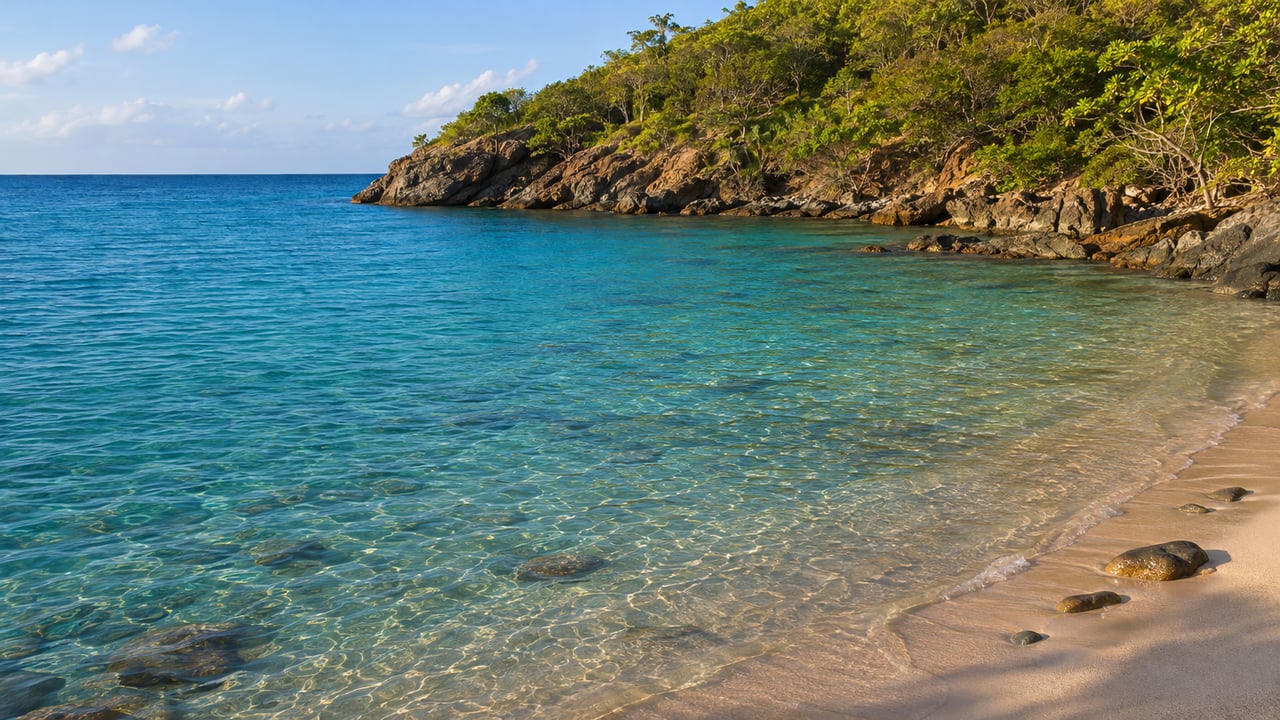
Salt Pond is the easiest of the four. You reach it from Route 10 through Coral Bay. In ExploreSTJ's 2022 description, it is a short downhill walk from a parking lot to a beach with little shade. The National Park Service's Salt Pond Bay page describes a gentle slope into clear water and lists limited parking and restrooms. The walk in is an uneven, rocky quarter-mile trail.
Two trails start from the same beach, and the swell shows up on both. The Drunk Bay walk, as News of St. John describes it, crosses rocky formations to a shoreline where waves break along the cliffs. Drunk Bay is a walk for the view, with the swimming left to Salt Pond. The Ram Head Trail is the steep, strenuous 0.9-mile climb that NPS lists from the same trailhead. On a north-swell day, Ram Head shows you the weather on both coasts at once. Friends of Virgin Islands National Park lists both the Ram Head Trail and the spur to Drunk Bay among the trails its crews maintained between October 2025 and September 2026.
Past the pavement to the Lameshur bays
Lameshur is where the south shore asks more of the driver. A News of St. John guide to Yawzi Point from November 2024 describes the drive along Route 107 through Coral Bay and then onto the Lameshur dirt road. It calls the road rough and riddled with potholes and recommends four-wheel drive. By that account, the stretch from the end of the pavement to Little Lameshur takes about 20 minutes for roughly two miles. In December 2025, the St. Thomas Source reported that since hurricanes Irma and Maria in 2017, vehicle access to Lameshur had been "nearly impossible" because of ponding, the large puddles that form on the unpaved road when runoff comes down the steep terrain after heavy rain.
The two bays at the end are different from each other. ExploreSTJ found Little Lameshur calm during the 2022 swell and describes it as sandy, while Great Lameshur is rocky. Yawzi Point sits between the two. News of St. John describes snorkeling there with underwater caves, juvenile reef fish, sea fans, and elkhorn and brain coral. The same guide warns that the point often has moderate waves and can be a difficult swim. Calm water at Little Lameshur does not mean calm water at the point, so it is a good idea to look at the water off the point before going in. The same guide describes a 0.5-mile trail to remote Europa Bay, the farthest stop on this stretch.
There is more on land at Lameshur than at Salt Pond. In its December 2025 report, the Source listed the site of the old Tektite underwater habitat, mangroves, the ruins of a colonial plantation and sugar factory, and a prehistoric site dating to around 500 BCE. The area is also home to the Virgin Islands Environmental Resource Station, managed by the University of the Virgin Islands. Friends of the Park's crews worked the Lameshur Bay Trail, the Yawzi Point Trail, the Tektite Trail, the Europa Bay and Europa Point spurs, and the Reef Bay Greathouse Spur during the year that ended in September 2026. The youth Summer Trail Crew was assigned to the Yawzi Point and Genti Bay trails.
The Lameshur Road project and this season
Last December, it looked as though this winter might cut Lameshur off from the land. At a St. John Coastal Zone Management meeting on December 9, 2025, officials from the Federal Highway Administration and the national park presented a plan to rehabilitate nearly three-quarters of a mile of the Lameshur Road. The plan covered grading, an aggregate surface, new low-water crossings, drainage and ditch work, and a new parking area next to a recently built toilet facility, which would replace the roadside parking that has damaged vegetation. The plan did not include paving. In the Source's account of the meeting, St. John CZM chair Andrew Penn called it "kind of a messy fix … for such a popular spot." Deputy Superintendent Scott Simmons said the park was "proceeding with the plan" to match the available funding.
The timeline presented that night had a contractor selected by August 2026, construction from September through February 2027, and the road closed for those six months. The only public access to Lameshur would have been by boat.
That construction season did not start. The federal bid for the "Rehabilitation of Lameshur Road" went up on SAM.gov on July 2, 2026, with an expected cost of $2 million to $3 million and bids due August 11. On September 21, 2026, the solicitation was marked canceled "due to funding constraints." The project, numbered 0060-25-FHWA, still appears among the projects available for review on the territory's Coastal Zone Management federal-consistency page.
So the planned boat-only closure did not begin on its September schedule, and the repairs that would have regraded the low spots have not been made. The road to Little Lameshur goes into this swell season as the same unpaved, ponding-prone road described in the 2024 and 2025 reporting above, and its condition on any given day depends on the recent rain.
The road also matters to the research station. In November 2024, the St. John Source reported that UVI had finished renovating the VIERS lab, that the station had been closed since the 2017 hurricanes, and that rebuilding the Lameshur Road was critical to reopening it.
Choosing a bay on a swell day
On a swell day, the choice comes down to your vehicle, the recent rain and the time you have. Salt Pond has the shortest walk and the best facilities, and you can reach it on pavement. The trade-offs are limited parking and little shade. The Lameshur bays add the dirt road and a quieter end of the island, with Little Lameshur's sand, the Yawzi Point snorkel when the point is calm enough, and the ruins and trails behind the beaches. Europa Bay adds another half-mile on foot.
ExploreSTJ also named Hansen Bay out on the East End as a third option. Its 2022 guide describes a sandy beach reached along Route 10 over steep hills, with parking on private land for a donation. Our East End summer mornings post covers that end of the island. Between Salt Pond and Lameshur, the Reef Bay valley has its own ways down to the water, and our Reef Bay neighborhood page covers the wider south side. When the swell drops and the North Shore calms down again, the park's free programs around Cinnamon Bay and Maho run on their own weekly schedule.
When the Weather Service puts a high-surf statement on the North Shore this winter, our concierge team at Bonvi Hospitality Group is glad to help guests plan a calm-water day on the south shore with on-island knowledge, from Salt Pond to the end of the Lameshur road. Let's Connect.